
Atlas
Field Inventory Software for Forest and Nature Management
Atlas is a powerful yet easy-to-use field service platform designed for professionals working with forest, landscape, and environmental data. Whether you manage forest inventories, biodiversity surveys, or infrastructure in natural environments, Atlas helps your teams collect accurate data in the field and turn it into actionable insights in the office.
Atlas
![]()
Work smarter in the Field
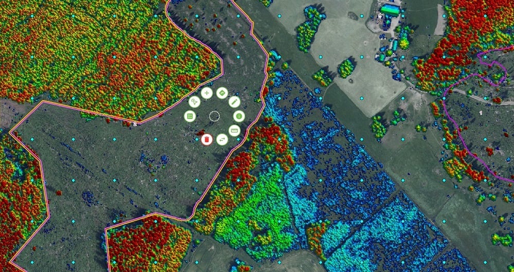
Atlas provides an intuitive, map-based interface that allows field teams to collect and update geospatial data directly on their mobile devices.
Because Atlas works online and offline, teams can continue working even in remote forest areas without network coverage. Data automatically synchronizes once connectivity is restored, ensuring that field observations are instantly available to the entire organization.
Benefits:
- Collect reliable field data anywhere – even offline
- Reduce paperwork and manual data entry
- Ensure consistent data quality with built-in validation
- Synchronize field observations with the office in real time
Built Around the Map
Atlas revolves around the map. Field users can easily:
- Navigate to inventory plots or survey areas
- Record observations and measurements
- Attach photos and documentation
- View existing datasets and project layers
The simple mobile interface makes it easy for field staff to focus on the work - not the software.
Full Control in the Office
While field teams collect data, project managers and administrators maintain full control from the Atlas administrative workspace.
Managers can:
- Assign tasks to field teams
- Monitor progress across large geographic areas
- Control who can view or edit specific datasets
- Manage projects involving multiple organizations or contractors
This ensures efficient coordination of large-scale inventory and monitoring projects.
Reliable Data – From Field to Database
Atlas ensures that data is collected correctly from the start.
Built-in validation rules help prevent errors and ensure that all data follows defined standards. Once collected, information is automatically synchronized and securely stored.
The result: consistent, reliable datasets that are ready for analysis, reporting, or integration with GIS systems.
Kontakta oss


Programvara
Field erbjuder mjukvaruprodukter som ger värde till kunder och partners över hela världen. Våra molnbaserade programvaruprodukter hjälper våra kunder att enkelt komma åt och använda sina data.Våra programvaruprodukter stöder externa datakällor som WMS/WMTS eller lokala vektordata för att ge dig exakta och värdefulla insikter online. Utforska mer Field och tjänster nedan.


